Sultanahmet Map: Your Ultimate Guide to Istanbul’s Historic Center
Table of Contents
Introduction
When you think of Istanbul, one of the first places that likely comes to mind is Sultanahmet. The historic center of this vibrant city is not only an essential hub for culture, history, and architecture, but it’s also a place full of wonders that can leave you in awe. A Sultanahmet map isn’t just helpful – it’s almost essential if you want to navigate this iconic district efficiently. In this article, we’ll explore why Sultanahmet is so important and how a map can make your visit easier, more enjoyable, and enriching.
What is Sultanahmet?
Sultanahmet is the heart of Istanbul’s Old City, located on the European side of the city. It’s packed with cultural and architectural marvels that date back to the Byzantine and Ottoman eras. From grand mosques to palaces and ancient cisterns, Sultanahmet is a blend of history, culture, and tradition.
Key landmarks that define the area include the Hagia Sophia, Blue Mosque, Topkapi Palace, and more. These sites don’t just tell the story of a city – they tell the story of an empire.

Why You Need a Sultanahmet Map
Without a map, navigating the maze of ancient streets, squares, and alleys of Sultanahmet can be challenging, especially if you’re new to the area. A Sultanahmet Istanbul city map ensures that you don’t miss out on anything and helps you get from one iconic spot to another with ease. For tourists, having a map makes planning easier and allows you to manage your time well.
Key Landmarks in Sultanahmet to Locate on Your Map
Sultanahmet is filled with remarkable landmarks. Here’s a look at some you’ll want to locate on your map:
The Hagia Sophia
Arguably Istanbul’s most famous landmark, the Hagia Sophia has been a church, a mosque, and now a museum. A must-see for visitors, it’s famous for its stunning architecture, mosaics, and immense dome. Knowing where it’s located on your map is key to exploring its grandeur.
The Blue Mosque
A stone’s throw from the Hagia Sophia, the Blue Mosque is a masterpiece of Ottoman architecture. Its six minarets and interior, adorned with blue tiles, create an awe-inspiring atmosphere. This mosque is an iconic spot for tourists and a symbol of the Islamic world.
Topkapi Palace
The Topkapi Palace was once home to Ottoman sultans, and it’s now a museum full of rich history, royal treasures, and intricate courtyards. A detailed map will help you navigate this expansive palace complex with ease.
Basilica Cistern
The Basilica Cistern is a fascinating underground water reservoir with its own charm. It’s not the easiest place to find if you don’t have a map, so be sure to mark it down for your visit.
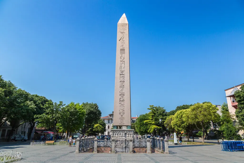
Hippodrome of Constantinople
Once the site of chariot races, the Hippodrome is now a public park with ancient columns and monuments. A map can help you locate the remnants of this historic site.
How to Use the Sultanahmet Map Effectively
A Sultanahmet map can serve as your best friend while exploring the area. To maximize its value:
- Plan your route: Start at Sultanahmet Square, where most of the key attractions are located.
- Make use of walking tours: Walking tours are a great way to explore the district, and a map can help you plan out the most efficient routes.
- Allocate time wisely: Some sites, like the Hagia Sophia or Topkapi Palace, may require more time to explore, so plan accordingly.
Digital vs Paper Maps of Sultanahmet
While digital maps on your phone offer the convenience of real-time updates and directions, some travelers prefer the tactile experience of a paper map. Both have their advantages, but in an area as historic as Sultanahmet, a paper map can add an extra layer of charm to your visit.
Sultanahmet Walking Tour Map: Recommended Route
If you’re planning a walking tour, here’s a suggested route to follow using your map:
- Start at Sultanahmet Square, which is the central hub.
- Visit the Hagia Sophia, followed by the Blue Mosque just across the square.
- Head to the Topkapi Palace, and then to the Basilica Cistern.
- Finish with the Hippodrome and take time to enjoy the surrounding cafes and shops.
Transportation Options in Sultanahmet
Sultanahmet is well-connected by public transport. The tram system is a great option for reaching the district, and once you’re there, walking is the best way to explore. Most major attractions are within walking distance of each other.
Exploring the Surroundings of Sultanahmet
While Sultanahmet itself is a major attraction, the surrounding areas like Eminönü, Galata, and the Grand Bazaar are also worth exploring. You can easily navigate to these areas with your Sultanahmet map.
Tips for Navigating Sultanahmet with Your Map
- Best times to visit: Early morning or late afternoon to avoid the crowds.
- Avoiding crowds: Use your map to visit off-the-beaten-path spots, like hidden courtyards or less-known museums.
- Local etiquette: Be respectful at religious sites, such as the mosques.
Where to Find Reliable Sultanahmet Maps
You can pick up free Sultanahmet maps at tourist information centers, hotels, and local shops. If you prefer digital maps, there are several mobile apps you can download.
Top Sultanahmet Map Apps for Tourists
Several apps can make navigating Sultanahmet even easier:
- Google Maps: Reliable and widely used, with walking routes and tourist spots.
- CityMaps2Go: Offers offline maps with detailed tourist information.
- Istanbul Maps & Offline Travel Guide: Perfect for tourists exploring Istanbul.
How a Map Enhances Your Sultanahmet Experience
A map not only helps you find your way but also gives you historical context for each landmark. This can enrich your experience, allowing you to appreciate the beauty and history of each site.
Common Mistakes Tourists Make Without a Map
Without a map, it’s easy to miss out on key spots or waste time getting lost. Many tourists also overlook hidden gems that aren’t on the main tourist route, but a good map can point them out.
Conclusion
Sultanahmet is a historical treasure trove, and with a map in hand, you can ensure that you won’t miss any of its wonders. Whether you prefer digital or paper maps, being equipped with one will guarantee that your visit is smooth, enriching, and full of unforgettable moments.
FAQs
1. What is the Sultanahmet Map?
The Sultanahmet Map is a detailed guide designed to help visitors navigate the historical Sultanahmet area in Istanbul. It highlights major landmarks, transportation options, restaurants, hotels, and cultural spots.
2. What landmarks are included on the Sultanahmet Map?
The map includes popular attractions such as the Hagia Sophia, Blue Mosque, Topkapi Palace, Basilica Cistern, Hippodrome, and the Grand Bazaar.
3. Is the Sultanahmet Map available in English?
Yes, the map is available in multiple languages, including English, to assist international tourists.
4. Can I access the map online?
Yes, the Sultanahmet Map is available online through tourism websites, travel apps, and in some cases, Google Maps overlays.
5. Is there a printable version of the Sultanahmet Map?
Yes, printable versions are often available at hotel lobbies, tourism offices, and on official Istanbul tourism websites.
6. Does the map show public transportation stops?
Absolutely. The map includes tram stops, metro connections, and key bus routes for easy navigation.
7. Is the map updated regularly?
Official versions are updated regularly to reflect changes in infrastructure, road access, or attractions.
8. Where can I get a physical copy of the Sultanahmet Map?
You can get a free physical copy at Istanbul Airport, hotels in the Sultanahmet area, tourist information centers, and museum entrances.
9. Are restaurants and cafes marked on the map?
Yes, many maps highlight popular dining spots, especially those close to major attractions.
10. Can I use the map for walking tours?
Definitely. The Sultanahmet Map is ideal for self-guided walking tours, with clearly marked paths and distances between attractions.
11. Does the map include information about ticket prices or opening hours for attractions?
Some versions of the map—especially those provided by tourism offices or hotel concierges—include useful information like ticket prices, opening and closing hours, and even estimated visit durations for key attractions.
12. Are guided tour routes included in the map?
Yes, some detailed maps highlight suggested walking routes for guided or self-guided tours, often categorized by historical themes, time availability, or types of attractions (museums, religious sites, etc.).
13. Is the map suitable for people with mobility issues?
Many Sultanahmet maps indicate pedestrian-friendly areas, stairs, ramps, and accessible routes for wheelchairs or strollers. However, the terrain in some historic areas may be uneven, so it’s best to check accessibility details in advance.
14. Are restrooms and ATM locations marked on the map?
Yes, comprehensive maps often include practical information such as public restrooms, ATMs, pharmacies, and emergency contact points.
15. Is Wi-Fi access information available on the map?
Some maps, particularly digital or app-based versions, show free Wi-Fi zones and nearby cafes or spots with internet access.
16. Does the map include nearby neighborhoods outside of Sultanahmet?
While the focus is on the Sultanahmet area, some maps extend to nearby districts like Eminönü, Sirkeci, and Beyazıt for easier orientation and broader sightseeing.
17. Can I use the map offline?
Yes. Many mobile apps allow you to download the Sultanahmet Map for offline use, which is very helpful if you don’t have mobile data while traveling.
18. Are emergency services marked on the map?
Yes, maps usually include information about nearby hospitals, police stations, and tourist support centers.
19. Can I use the map for planning my itinerary?
Absolutely. The Sultanahmet Map is a great tool for planning your daily sightseeing schedule, especially when organizing visits based on proximity and walking distance.
20. How accurate are the distances shown on the map?
Most modern maps use GPS-based measurements and offer fairly accurate distances, ideal for estimating walking times between sites.
21. Does the map include shopping areas or souvenir shops?
Yes, many maps highlight popular shopping streets, bazaars, and souvenir shops—especially places like the Grand Bazaar, Arasta Bazaar, and shops around the Hippodrome.
22. Is there a QR code or digital version linked to the physical map?
Modern physical maps often come with a QR code that links to an interactive digital version, which can offer features like navigation, user reviews, and updates in real-time.
23. Are museums and galleries clearly marked?
Yes. Museums such as the Museum of Turkish and Islamic Arts, Istanbul Archaeological Museum, and others in the area are usually marked with distinct icons for easy identification.
24. Can I find recommended photo spots on the map?
Some enhanced maps, especially those designed for tourists, include recommended scenic viewpoints and photo-friendly spots near attractions like the Blue Mosque or Gülhane Park.
25. Is the map useful for evening or night visits?
While many attractions close by early evening, the map can still be helpful for exploring illuminated landmarks, finding open restaurants, or enjoying an evening stroll along the Bosphorus. Night-safe zones and well-lit paths are often marked.
26. Are prayer times or mosque etiquette included?
Certain cultural maps may include prayer times for major mosques and tips for respectful visiting (e.g., dress codes, visiting hours for non-Muslims, etc.).
27. Can the map help with connecting to other parts of Istanbul?
Yes, Sultanahmet is well-connected. The map typically includes transport hubs like the T1 tram line, ferry terminals at Eminönü, and directions to metro lines for traveling to Taksim, Kadıköy, or the airport.
28. Is there a kid-friendly version of the Sultanahmet Map?
Some tourist centers offer family-friendly maps that highlight parks, kid-appropriate attractions (like the Istanbul Toy Museum or miniature parks), and places with stroller access.
29. Who designs and maintains the Sultanahmet Map?
Maps are typically created by Istanbul’s tourism board, private travel agencies, or hotel consortia, with regular updates based on city planning and feedback from travelers.
30. How can I give feedback or suggest improvements for the map?
Most printed or digital maps include contact info or a feedback section. You can usually leave reviews through travel apps, city tourism websites, or QR-linked surveys.
31. Are there audio guides or companion apps linked to the map?
Yes, some versions of the Sultanahmet Map—especially those distributed through travel apps—include links to audio guides or augmented reality features for a more immersive experience at each site.
32. Can I find food recommendations on the map?
Definitely. Many maps spotlight recommended local restaurants, traditional Turkish eateries, street food stalls, and cafes—sometimes categorized by type of cuisine or budget.
33. Are safety tips or cultural guidelines included?
Yes. Tourist maps often include short notes on local customs, dress codes for mosque visits, safety tips, and emergency contacts to help travelers stay informed and respectful.
34. Is the map available year-round?
Yes, Sultanahmet maps are distributed throughout the year, although special editions might be available during peak tourist seasons or festivals like Ramadan or Istanbul Tulip Festival.
35. Do hotels in Sultanahmet provide free maps?
Most hotels in Sultanahmet do offer free printed maps at the reception or concierge desk—often with personalized recommendations marked by staff.
36. Can I request a custom-marked map for my itinerary?
Some boutique hotels or private tour operators in the area offer personalized maps tailored to your interests, such as history, shopping, food, or religious sites.
37. Is there a version of the map for history buffs or academic travelers?
Yes, specialized maps exist that highlight the deeper historical context of each site, archaeological details, and even QR codes linking to academic articles or museum exhibits.
38. Are updates announced anywhere when the map changes?
Digital versions often notify users of updates via app alerts or email subscriptions. Physical versions usually reflect updates seasonally or annually, especially if tied to major tourism campaigns.
39. Can I get the map at the airport or train station?
Yes, Istanbul Airport, Sabiha Gökçen Airport, and major transport hubs like Sirkeci Train Station typically offer maps through information desks or tourism kiosks.
40. What should I do if I lose the physical map?
No worries! You can easily download a new one online from Istanbul’s official tourism website, your hotel’s website, or scan a QR code from public boards in the Sultanahmet area to access a digital version.
41. Are walking distances between attractions marked on the map?
Yes, many maps show approximate walking times or distances between major landmarks, which helps visitors plan their route efficiently—especially since most sites are within a 10-15 minute walk from one another.